A Python script that uses the Global Fishing Watch API to retrieve AIS event locations for a vessel and then uses Google Earth Engine to download matching Sentinel‑2 satellite imagery. It generates geospatial metadata files for each image and applies basic enhancements like upscaling, sharpening, and gamma correction. The output is a set of georeferenced, processed satellite images aligned to vessel activity.
1. Importing Libraries and Setting Up Parameters
Libraries used: Google Earth Engine, geemap, pandas, cartopy, PIL, cv2, and others. Parameters: the vessel name, MMSI, date range, and a base directory for storing outputs.
The notebook includes values such as:
vessel_mmsi = '311042900'max_downloads = '1000'
This gives a clean, reproducible setup.
2. Authenticating and Querying the Global Fishing Watch API
Loaded GFW API access token from an environment file and created the client. A function is used to resolve the MMSI into GFW vessel IDs. The API returned:
“Disney Dream”
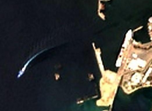
With the vessel IDs, port‑visit, encounter, and loitering events within the date range. Geometry was flattened into simple lat and lon columns and produced a clean DataFrame of AIS events.
3. Preparing Earth Engine and Downloading Sentinel‑2 Imagery
For each AIS event, a buffered bounding box was created around its coordinates.
The COPERNICUS/S2_SR_HARMONIZED collection was queried, filtered by date and cloud cover, selected RGB bands, and downloaded all matching images as JPEGs.
Example log entry:
“Row 2: downloading image 1/2 → row2_20260119T160201…jpg”
4. Generating Geospatial Sidecar Files
For each downloaded JPEG, sidecar files were generated:
- a
.jgwworld file - a
.prjprojection file (EPSG:4326) - a
.geojsonmetadata file containing bounding box, acquisition date, cloud percentage, and AIS event metadata
This ensured every image remained geospatially referenced.
5. Image Upscaling
Each JPEG was upscaled by 4× using Lanczos resampling. After resizing, the world‑file was recalculated with adjusted pixel size to maintain correct geospatial alignment.
Example log:
“Upscaled row10… to (840, 896)”
6. Image Sharpening (Unsharp Mask)
I applied an unsharp mask with:
- radius 2
- percent 150
- threshold 3
Sidecar files were copied unchanged.
Example log:
“Sharpened row39_20260705T155129…jpg”
7. Gamma Correction
Gamma correction was adjusted (γ = 0.8) to brighten midtones. Geospatial metadata remained untouched.
Example log:
“Gamma corrected row41… (gamma=0.8)”
8. Additional Enhancements (Exploratory)
I experimented with vibrance, saturation, contrast, and white balance adjustments, but decided they didn’t meaningfully improve the imagery.
9. Final Output Structure
Sentinel‑2 imagery aligned to AIS vessel events was organised into:
- raw downloads
- upscaled images
- sharpened images
- gamma‑corrected images
- full geospatial metadata for each file
This workflow provides a reproducible pipeline for linking AIS events to satellite imagery and enhancing the results for analysis or visualisation.